
The French département of Ardèche enchants its visitors with many spectacular natural monuments. The mountain landscapes of the eastern Massif Central are grouped together in the Monts d’Ardèche Regional Nature Park . Established in 2001, the nature park covers an area of about 180,000 hectares and is distinguished by many varied landscape structures. The towns of Privas, Aubenas, Saint-Agrève, Les Vans, Lamastre and Vernoux-en-Vivarais lie on the edge of the park and form its access points.
Landscapes in the Monts d’Ardèche Nature Park
The Monts d’Ardèche Nature Park is characterised by varied mountain landscapes, made accessible to visitors by numerous well-developed hiking trails. The mountain range on the eastern edge of the Massif Central has a wealth of different landscape zones, at altitudes between 170 and 1,753 metres.
The northern landscapes of the Monts d’Ardèche Nature Park
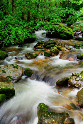
Between Privas and Saint-Agrève, in the north of the park, lies the region of the Boutières. This area is characterised by slopes and gorges crossed by the Eyrieux and its tributaries. Sweet chestnuts have long been grown on steep terraces in the Boutières, so the landscape is shaped by the stone walls built around the terraces. To the north-west it is followed by the Vernoux plateau , which forms an enclave in the Boutières. The high plateau rises 500 metres above the Eyrieux valley, opening up a beautiful view over the Monts d’Ardèche Nature Park. Otherwise the Vernoux plateau is characterised by forests, gentle hills and pastureland. The north-west of the nature park is occupied by the Sucs area. In contrast to the Boutières, the Sucs are characterised by a volcanic landscape. Typical of the area are the small volcanic cones that resemble sugar loaves.
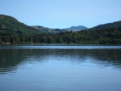
In the Sucs, with Mont Mézenc , lies the highest mountain of the nature park. The Suc de Montivernoux, the Taupernas and Mont Gerbier-de-Jonc also invite you to hike and climb. The Loire rises in the middle of this fairly unspoilt mountain landscape. You can also discover a rich flora and fauna here.
Landscapes in the centre and south of the Monts d’Ardèche Nature Park
The Haute Cévenne lies in the centre of the Monts d’Ardèche Nature Park. In this region too you will find a spectacular volcanic landscape with craters, volcanic cones and maars. In addition, the Haute Cévenne is shaped by the rivers Volane, Sandron and Bézorgues, which flow into the Ardèche in the valley.
Col de la Chavade view on a larger map
At the Col de la Chavade you can visit the source of the Ardèche . In the south-west of the nature park lies the Cévenne Méridionale landscape. It is a typical low mountain landscape, whose centre is formed by the imposing Tanargue massif . The rugged landscape of the Cévenne Méridionale stretches between the Sommet de Mejan and the Lozère département. Particularly worth seeing are the small villages nestling on the mountain slopes. The most famous place is Saint-Laurent-les-Bains with its thermal springs. Towards the south, the Cévenne Méridionale gives way to a Mediterranean landscape of olive and chestnut trees. Piémont Cévenol is the south-eastern landscape of the nature park. It comprises a narrow strip between Les Vans and Aubenas. Here you will find a Mediterranean landscape in which wine-growing is practised. There are also olive plantations near Les Vans. Two rivers excellent for white-water sports flow through the Piémont Cévenol: the Drobie and the Beaume.